Image

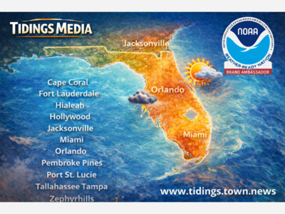
As Tidings continues to get educated as part of our working with the National Weather Service's NOAA Weather-Ready Nation Ambassador™ initiative, we're learning a nerd's level of information regarding hurricane modeling. Of course, we're going to share our nerd MBA with you here at Tidings Media.
Forecasters predict hurricanes by using a variety of tools, including satellite imagery, radar data, atmospheric observations, and computer models. The process of predicting hurricanes involves analyzing weather patterns, wind patterns, and other meteorological data to identify areas of low pressure that could develop into hurricanes.
One of the primary tools that forecasters use to predict hurricanes is computer models. These models are complex computer programs that use mathematical equations to simulate the behavior of the atmosphere and ocean. They take into account factors such as temperature, humidity, wind, and pressure to predict how a storm will develop and move.
There are several different types of hurricane models, each with its own strengths and weaknesses. Some models focus on the physical processes that drive hurricanes, such as the movement of air and water, while others focus on statistical patterns in past storms. Some models use a combination of these approaches to make predictions.
One of the most widely used hurricane models is the Global Forecast System (GFS), which is developed by the National Oceanic and Atmospheric Administration (NOAA). The GFS model uses complex algorithms to simulate the behavior of the atmosphere and ocean, and it is updated several times a day based on the latest meteorological data. We'll get some early alerts here at Tidings through our relationship with the National Weather Service through the NOAA Weather-Ready Nation Ambassador™ initiative. Make sure you have signed up for the Tidings email alerts as we'll push what ever we can through our alert system there when the time comes. Tidings regular forecasts come through AccuWeather, but our emergency alerts will come directly from NOAA, in coordination with Pinellas, Pasco and Hillsborough County's emergency communication teams. Tidings readers will have the best information as fast as possible as we're in direct communication with the National Weather Service, providing them information from Tampa Bay and giving them information.
Other commonly used hurricane models include the European Centre for Medium-Range Weather Forecasts (ECMWF) model, the Canadian Meteorological Centre (CMC) model, and the Hurricane Weather Research and Forecasting (HWRF) model. Each model has its own strengths and weaknesses, and forecasters typically use a combination of models to make their predictions.
In addition to computer models, forecasters also rely on their own experience and expertise to make predictions. They use a combination of data analysis, scientific knowledge, and intuition to assess the likelihood of a storm forming and the potential impact it could have.
No article would be complete without mentioning the best meteorologist in the world, Denis Phillips from ABC Action News. We are blessed here in the Bay area to have Denis Phillips, and his rule #7 will always be used in conjunction with the new Tidings TideWatch Storm Center™ coverage and NOAA news feeds right here at Tidings Media.


Sunny, with a high of 93 and low of 77 degrees. Sunny in the morning, patchy rain nearby during the afternoon and evening, clear overnight.