Image

NOAA’s National Hurricane Center is rolling out a redesigned hurricane forecast cone for the 2026 season, aimed at helping communities better understand their risk from tropical storms and hurricanes.
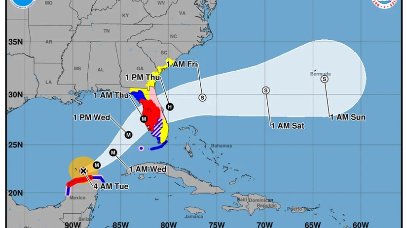
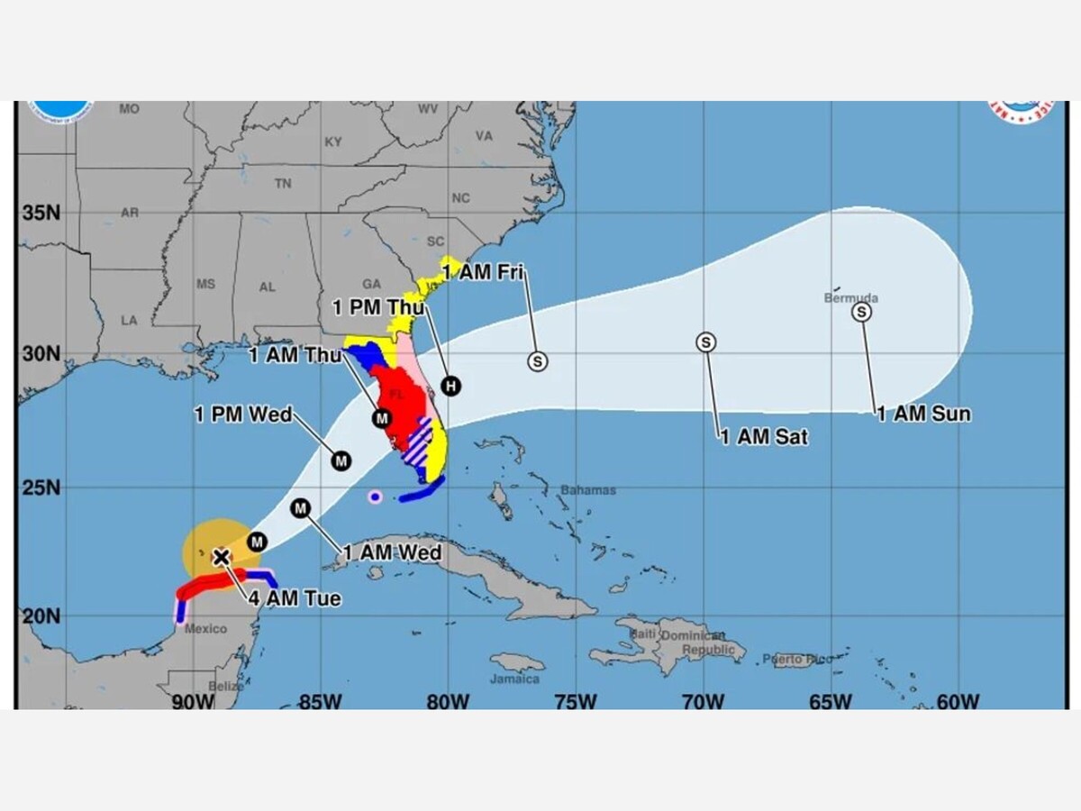
An example of the updated 2026 version of the cone graphic for Hurricane Milton (2024) that shows inland watches and warnings.(Image credit: NOAA National Hurricane Center)
NHC Director Michael Brennan said the improvements will help people “prepare earlier and more effectively” for dangerous wind hazards.
In 2025, as in years past, the impact of hurricanes was felt not only on coastal regions but traveled inland all up and down the Pacific coast. This new updated forecast cone will show inland alerts and possible storm trajectories.
For the first time, the operational forecast cone will include tropical storm and hurricane watches and warnings for inland areas, not just coastal zones. The update follows a successful experimental phase in 2025 that showed inland alerts helped more communities anticipate wind impacts far from the shoreline.
Key features of the updated 2026 cone include:

Hurricane season begins May 30 and runs through November. The National Oceanic Atmospheric Administration will issue their hurricane season outlook in May.
The 2025 hurricane season produced 13 named storms, five hurricanes, and four major hurricanes, including three Category 5 hurricanes. For comparison, an average season typically sees 14 named storms, seven hurricanes, and three major hurricanes.
Tidings Media is a NOAA Weather Ready Nation Brand Ambassador, and our free email alert system features updated information from the National Weather Service and other storm related alerts provided by The Weather Channel and AccuWeather.


Sunny, with a high of 96 and low of 76 degrees. Sunny for the morning, haze overnight.