Image

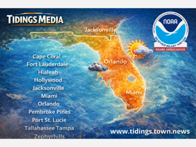
Tidings Media is a Weather Ready Nation Brand Ambassador for NOAA. Subscribe for free for alerts!

Florida is back in its summer weather rhythm: hot, humid afternoons followed by scattered showers and thunderstorms, especially where sea breezes collide over the interior of the state.
The National Weather Service office in Tampa Bay said Friday afternoon that high pressure will remain in control over West Central Florida, with light west winds expected over the next several days. The best rain chances are expected over land, although a few showers or storms could move over Gulf waters overnight or during the early morning hours. No marine headlines were expected as of the Friday afternoon discussion.[1]
In North Florida and the Panhandle, the National Weather Service office in Tallahassee reported hot and mostly dry conditions Friday, with afternoon temperatures generally in the middle 90s. Isolated showers and thunderstorms were expected along the sea breeze, with heat index values forecast to reach the 106 to 110 degree range on Saturday. Rain chances are expected to increase into Sunday and Monday, with locally heavy downpours possible in storms, although no significant flash flooding or river flooding was expected through the weekend.[2]
In Northeast Florida, the Jacksonville forecast office warned of high heat risk through the weekend, with heat index values in the 100 to 105 degree range Friday and possible Heat Advisory conditions Saturday, when peak heat index values could reach 104 to 108 degrees. The same forecast discussion pointed to increasing thunderstorm chances this weekend into next week, with strong storms capable of gusty winds, frequent lightning and heavy downpours, especially near the I-95 corridor beginning Saturday.[3]
Central Florida is also in the storm zone. The National Weather Service office in Melbourne said higher coverage of afternoon and evening showers and storms is expected to persist into next week. The main threats are lightning strikes, gusty winds of 40 to 50 mph, and locally heavy rainfall from slow-moving storms. The Melbourne office also noted that above-normal temperatures and deep low-level moisture will keep heat index values in the 100 to 107 degree range during the afternoons, including around the Orlando metro area.[4]
In South Florida, the Miami forecast office said scattered thunderstorms were expected Friday afternoon into early evening, favoring inland and Southwest Florida. Heavy rain could lead to poor drainage or urban flooding in Southwest Florida, and maximum heat index values of 100 to 105 degrees were possible through the weekend.[5]
The pattern is not unusual for June in Florida, but it is still dangerous. Lightning is one of Florida’s most persistent warm-season hazards. Heavy downpours can quickly overwhelm streets, parking lots and low-lying drainage areas. Heat index values above 100 degrees can become especially dangerous for outdoor workers, children, the elderly, pets and anyone without reliable air conditioning.
For residents, the practical advice is simple: check the forecast before outdoor plans, hydrate early, avoid the hottest part of the day when possible, bring outdoor work inside when thunder is nearby, and never drive through flooded streets. Boaters should also watch for storms that form over land and move toward the water during the evening or overnight.
NOAA’s drought information for Florida currently shows improvement compared with the drier spring pattern, with the Climate Prediction Center indicating no drought present and no drought development predicted for the state at this time.[6] That is welcome news, but it does not erase the immediate risks of heat, lightning, and localized flooding from slow-moving summer thunderstorms.
Tidings Media will continue watching local National Weather Service offices across the state, including Tampa Bay, Tallahassee, Jacksonville, Melbourne, Miami and Key West, as Florida moves deeper into hurricane season.
Tidings Media is also proud to be a NOAA Weather-Ready Nation Brand Ambassador. NOAA describes the Weather-Ready Nation Ambassador program as a way to formally recognize partners that help improve readiness, responsiveness and resilience against extreme weather, water and climate events.[7] For Tidings Media and our readers across Florida, that means we take weather communication seriously. Our goal is not to hype storms or create panic. It is to help Floridians stay informed, prepare early, and make better decisions before weather turns dangerous.
Stay connected with Tidings Media: Tidings Media offers local curated news for Tampa, Tallahassee, Miami, Jacksonville, Orlando, Port St. Lucie, Fort Lauderdale, Cape Coral, Hialeah, Hollywood, Pembroke Pines, and Zephyrhills. Subscribe free at tidings.town.news for local headlines, weather alerts, civic updates, practical Florida news, and community stories without the clutter.
Footnotes
[1] National Weather Service Tampa Bay Area Forecast Discussion, June 12, 2026.
[2] National Weather Service Tallahassee Area Forecast Discussion, June 12, 2026.
[3] National Weather Service Jacksonville Area Forecast Discussion, June 12, 2026.
[4] National Weather Service Melbourne Area Forecast Discussion, June 12, 2026.
[5] National Weather Service Miami Area Forecast Discussion, June 12, 2026.
[6] NOAA Drought.gov Florida page.
[7] NOAA Weather-Ready Nation Ambassador program.


Sunny, with a high of 98 and low of 78 degrees. Sunny in the morning, clear for the afternoon and evening,